Drone-based multispectral mapping that produces centimeter-accurate ground maps — delivering water stress analysis, erosion mapping, soil uniformity insights, and vegetation structure monitoring for any terrain or crop type.
Satellites show you a field. Drones show you a tree. For land managers running hundreds of hectares, the difference compounds into real decisions — and real savings.
Every tree, every row, every gap — mapped in a single flight. Ground scouting samples maybe 5–10% of a block. We capture 100%.
Sub-centimetre resolution means individual blossoms, fruit set, and canopy gaps — not just "this zone looks stressed." Thinning, timing, per-tree treatment: decisions satellites can't support.
Precision application from drone NDVI maps cuts fertiliser and phytosanitary use by 20–30% on average. On a 100ha estate, that's a material line item every season.
New agronomist, new site manager, end-of-season crew change — every handover is a knowledge gap. Every flight leaves a permanent, timestamped record. Nothing gets lost.
Our platform works across tree crops, vineyards, open fields, meadows, golf courses, and non-agricultural terrain. We have automated tree detection and individual performance tracking built-in — but the mapping and analysis tools work on any landscape.
Apples, pears, stone fruit, nuts, olives, and citrus. Automated individual tree detection, canopy mapping, yield forecasting, and season-over-season performance tracking.
Vigor zoning, water stress mapping, row-level canopy analysis, and vintage-by-vintage spatial performance logs for wine and table grape producers.
Panel efficiency area mapping, vegetation encroachment monitoring, slope stability assessment, and terrain change detection for solar farms and infrastructure corridors.
Erosion mapping, vegetation health, surface uniformity, and topographic change detection for golf courses, sports turf, managed meadows, and mountain slopes.
Tree density analysis, biomass estimation, canopy cover mapping, and long-term change detection for forestry management and carbon credit verification.
Non-standard terrain, research plots, infrastructure corridors, archaeological sites, or bespoke monitoring requirements — our processing pipeline adapts. Get in touch to discuss your specific use case.
Already have a drone — now what? No GIS software, no specialist training. Just upload and go.
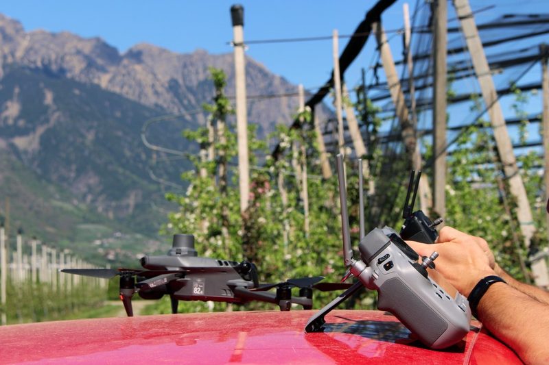
Fly your mission with any RTK/PPK drone you already own. Upload the raw imagery directly to the Arbor Insight portal — your hardware investment starts paying off from the first flight.
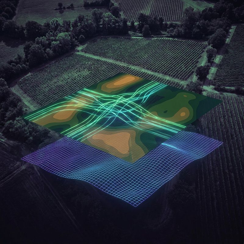
Everything happens in the cloud. Orthomosaic generation, spectral index calculation, map rendering — all processed automatically to the highest quality standard. No GIS expertise required.
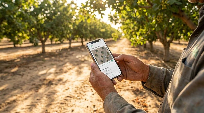
You're notified the moment your data is ready. Access all maps, overlays, and analyses from any device, anywhere. Priority queue customers receive a guaranteed 24-hour turnaround.
Six core capabilities, available for any supported terrain. No GIS software required — all outputs accessible directly from the web portal.
Sub-10cm resolution orthomosaics and surface models from any RTK/PPK-capable drone. Compatible with DJI and most commercially available platforms — no proprietary hardware required. Automated individual tree and object detection built in, no GIS expertise needed.
Water stress indices, erosion risk zones, soil uniformity layers, and vegetation health scores — derived from multispectral data and actionable before any visible symptoms appear in the field.
Localized temperature gradients, solar radiation patterns, and humidity variance mapped down to individual row segments — derived directly from drone spectral and thermal data, no external weather stations needed.
Side-by-side and overlay comparisons between any two surveys. See exactly what shifted — canopy gaps, terrain movement, vegetation loss, encroachment — and trace it back to a specific window in time.
Every flight automatically populates a structured database of your land assets — individual trees, rows, parcels, or zones. Each asset accumulates its own history: canopy size, health indices, stress events, and change flags across every survey. A record that grows more valuable with every flight.
Each survey produces a permanent, high-fidelity snapshot of your soil and terrain — elevation, texture, drainage patterns, and spectral signatures frozen at that exact moment. Store it, revisit it, and compare it against any future survey to detect drift, erosion, or compaction over time.
Real outputs from active deployments.
We'll walk you through a real dataset from an active deployment.
We process multispectral drone surveys using RTK/PPK positioning, achieving centimeter-precise spatial accuracy on every flight. That level of geospatial fidelity means even subtle changes — centimeter-scale surface shifts, early-stage stress patterns, minor canopy gaps — are captured cleanly. It also means each dataset aligns perfectly with the last, making time-series comparisons and season-over-season tracking as reliable as single-flight snapshots.
When combined with spectral indices and high-resolution orthophotos, the data our platform produces is the kind of foundation that supports environmental reporting, carbon accounting, and water efficiency analysis. The raw material for these use cases is there — how it gets applied depends on the workflow, the reporting standard, and the operator.
Arbor Insight is a precision AgTech company founded by Michael Chang and Edwin Pircher. We build drone-based multispectral mapping tools that give growers, land managers, and cooperatives a clear, data-driven view of their terrain — without requiring any GIS expertise or specialist hardware.
Offices in Bolzano, Italy and Milwaukee, Wisconsin — active across Europe and North America. Backed by Techstars Turin 2024.

"They have a Ferrari here — really a good front end. Very good thoughts."
Most tools you'll encounter were built for engineers, satellite analysts, or generic raster workflows — then awkwardly adapted for drone data. We built Arbor Insight from the ground up for land managers: upload your flight, get actionable outputs, no expertise required.
| Feature |
Arbor Insight
|
Desktop GIS Tools | Non-Specialist Data Services |
|---|---|---|---|
| Upload and go — zero setup required | ✅ | ❌ requires configuration | ❌ requires integration work |
| Fully automated processing — no manual steps | ✅ | ❌ manual workflows | partial |
| Drone-native processing (not adapted from satellite/raster tools) | ✅ | ❌ generic raster tools | ❌ satellite-first pipeline |
| Agronomist-ready outputs — no interpretation needed | ✅ | ❌ raw data only | partial |
| Works with any RTK/PPK commercial drone | ✅ | ✅ | varies |
| Centimetre-accurate spatial alignment — automatic | ✅ | manual setup | varies |
| Time-series & season-over-season comparison | ✅ | complex | ❌ |
| Multi-crop & multi-terrain support | ✅ | ❌ | limited |
| Cloud-native — no software to install, ever | ✅ | ❌ | ✅ |
Still comparing? Talk to us — we'll show you exactly what your data looks like after processing.
Priced by area, frequency, and feature set — no hidden fees. Operate from anywhere, serve any location worldwide.
🌍 Available globally — upload from anywhere, process in the cloud, access your data worldwide.
Not sure which drone to buy, or how to plan your first flight campaign? We advise on hardware selection for your specific terrain and use case, and design flight strategies that maximise data quality and coverage efficiency — so your first dataset is your best one.
New to drone mapping? Join our free live webinar and learn how to capture, upload, and interpret your first multispectral dataset — no prior GIS experience needed. Covers flight planning basics, data quality checks, and reading your first NDVI report.
Advanced paid workshops also available — drone data interpretation, precision input planning, and multi-season analysis.
Upload your first flight, get your data back within 24 hours. No GIS software, no specialist training — just upload, process, and act.